Corridor Plan Project

Overview
The recently completed Lycoming County Brownfield Assessment Program identified and evaluated brownfield opportunities in four municipal clusters around the County. Through that two corridors were identified as having extremely high redevelopment potential. Two seperate Corridor Plans will be developed: one for the City of Williamsport and one for the Borough of Montgomery.
Process
The Corridor Plans for the Old Mill Corridor and the Interstate 180 Corridor will be developed through the utilization of a three-step approach involving: Feasibility, Visioning, and Implementation. The three-step approach to the Corridor Plans will provide a comprehensive understanding of the areas and allow for community input to be integrated into realistic, implementable plans. For more details, please read our Scope of Work.
Feasibility
Visioning
Implementation
Outcomes
The Corridor Plans will give the municipalities the opportunity to plan for future development in a sustainable and innovative manner that highlights each municipality's individual character. With a long-range vision, the plans will provide a legacy for the future that transcends administrations, making this project adoptable and realistic.
Locations
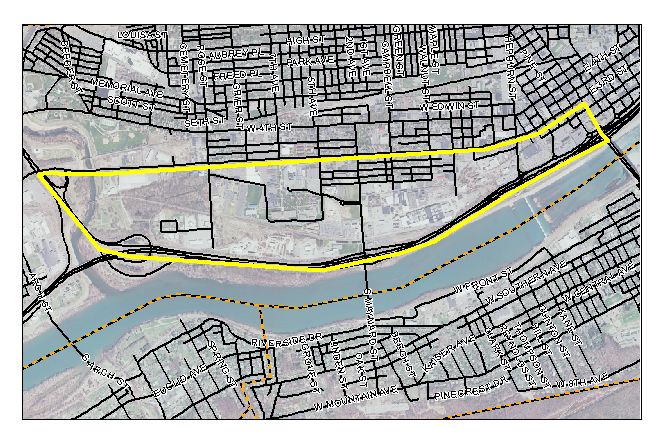
The Interstate 180 Corridor is outlined in yellow, below. It lies along the southern border of Williamsport and is bounded by Market Street on the east, US 15 on the west, I-180 on the south, and 3rd Street on the north.

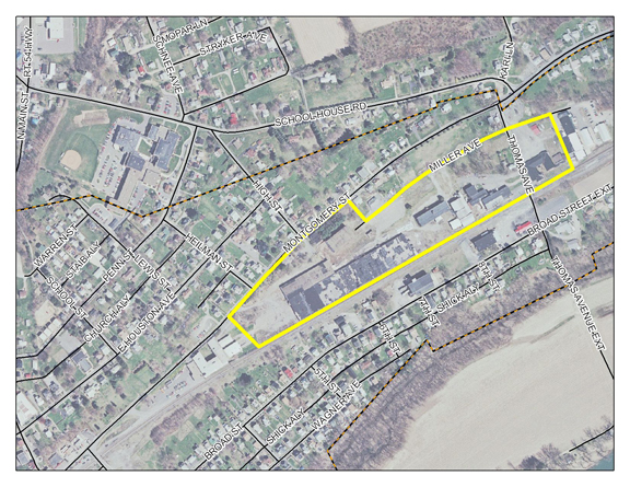
The Old Mill Corridor, below, is located in Montgomery Borough, south of Route 405. The area was once a center of textile manufacture.

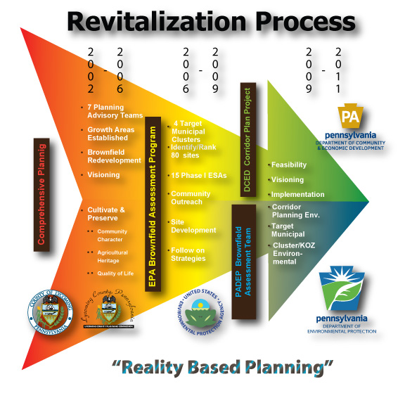
The revitalization process has been graphically rendered to show where the process has started and how we have progressed to where we are today. The arrow points forward to show that more work is needed with the ultimate goal being revitalization.
