 |
|
 |
 |
|
 |
 |
Links
|
-
Public involvement in the transportation planning process is a right of all residents of Lycoming County. Federal law requires that all MPO's develop and use a documented participation plan that defines the process for providing reasonable opportunities for public participation in the transportation decision-making process. The Public Involvement website has infomation on how you can participate in the transportation planning process, WATS MPO staff contact information, and the Transportation Planning Calendar.
Public involvement in the transportation planning process is a right of all residents of Lycoming County. Federal law requires that all MPO's develop and use a documented participation plan that defines the process for providing reasonable opportunities for public participation in the transportation decision-making process. The Public Involvement website has infomation on how you can participate in the transportation planning process, WATS MPO staff contact information, and the Transportation Planning Calendar.
-
A Metropolitan Planning Organization (MPO) is a federally mandated local planning body composed of elected and appointed officials representing local, state and federal governments or other agencies having an interest or responsibility in the local transportation system. The MPO is responsible for creating a Long Range Transportation Plan (LRTP), a Transportation Improvement Program (TIP), and a Unified Planning Work Program (UPWP). An MPO can be a regional, multicounty organization or a single county. The Williamsport Area Transportation Study (WATS) is the single county MPO covering Lycoming County.
A Metropolitan Planning Organization (MPO) is a federally mandated local planning body composed of elected and appointed officials representing local, state and federal governments or other agencies having an interest or responsibility in the local transportation system. The MPO is responsible for creating a Long Range Transportation Plan (LRTP), a Transportation Improvement Program (TIP), and a Unified Planning Work Program (UPWP). An MPO can be a regional, multicounty organization or a single county. The Williamsport Area Transportation Study (WATS) is the single county MPO covering Lycoming County.
-
-
Every five years, as required by federal law, the Lycoming County Department of Planning and Community Development updates the Williamsport Area Transportation Study MPO Long Range Transportation Plan (LRTP). The current LRTP was adopted December 17, 2018.
Every five years, as required by federal law, the Lycoming County Department of Planning and Community Development updates the Williamsport Area Transportation Study MPO Long Range Transportation Plan (LRTP). The current LRTP was adopted December 17, 2018.
-
As the federally designated metropolitan planning organization for Lycoming County, the Lycoming County Planning Commission works with the Pennsylvania Department of Transportation, River Valley Transit, (RVT) and STEP Inc.to develop the Transportation Improvement Program, (TIP). The TIP is a list of priority transportation projects that are proposed to be undertaken during the next four federal fiscal years using various federal, state and local funding sources. These transportation projects include a full range of highways, bridges, public transit, bicycle and pedestrian facilities.
As the federally designated metropolitan planning organization for Lycoming County, the Lycoming County Planning Commission works with the Pennsylvania Department of Transportation, River Valley Transit, (RVT) and STEP Inc.to develop the Transportation Improvement Program, (TIP). The TIP is a list of priority transportation projects that are proposed to be undertaken during the next four federal fiscal years using various federal, state and local funding sources. These transportation projects include a full range of highways, bridges, public transit, bicycle and pedestrian facilities.
-
The Unified Planning Work Program (UPWP) describes the transportation-related work activities that the Lycoming County Department of Planning and Community Development (PCD) and River Valley Transit (RVT) (with the aid of planning consultants, as necessary) will perform within Lycoming County. PCD and RVT staff jointly developed the work program. Within Lycoming County, Pennsylvania, the transportation planning process is conducted through the Williamsport Area Transportation Study (WATS). WATS was established in 1968. In Pennsylvania, UPWPs are developed as 2-year programs. However, this document is dynamic and may be modified to respond to any emerging priority issue or special need vital to the orderly growth and development of Lycoming County.
The Unified Planning Work Program (UPWP) describes the transportation-related work activities that the Lycoming County Department of Planning and Community Development (PCD) and River Valley Transit (RVT) (with the aid of planning consultants, as necessary) will perform within Lycoming County. PCD and RVT staff jointly developed the work program. Within Lycoming County, Pennsylvania, the transportation planning process is conducted through the Williamsport Area Transportation Study (WATS). WATS was established in 1968. In Pennsylvania, UPWPs are developed as 2-year programs. However, this document is dynamic and may be modified to respond to any emerging priority issue or special need vital to the orderly growth and development of Lycoming County.
-
The Pennsylvania Local Technical Assistance Program(LTAP) was created to share transportation knowledge, improve road maintenance and safety skills, and put research and new technology into practice at the municipal level.
The Pennsylvania Local Technical Assistance Program(LTAP) was created to share transportation knowledge, improve road maintenance and safety skills, and put research and new technology into practice at the municipal level.
-
-
-
This is the first round of municipal owned structurally deficient bridges that will be repaired in a county-wide bridge bundling program. By bundling the bridge projects, multiple bridges can be designed and constructed concurrently rather than as single projects. It is anticipated that up to a 30% overall cost savings can be achieved along with a considerably shortened project duration using this innovative approach. The Lycoming County Board of Commissioners enacted a Fee for Local Use Ordinance as authorized under PA Act 89. As a result, PennDOT will collect an additional $5 for every non-exempt vehicle registered to an address in Lycoming County and these funds will be provided back to the county on a semi-annual basis. The Commissioners' intent is to use these funds to fix or replace the growing backlog of municipality-owned structurally deficient bridges located throughout the County. Other revenue sources provided through PA Act 13 dedicated to bridges will also be used to finance this program. This revenue will be used to pay the debt service on a PA Infrastructure Bank, (PIB) loan the county would seek with PennDOT approval. The loan will serve as up front financing to undertake the bridge repair program.
This is the first round of municipal owned structurally deficient bridges that will be repaired in a county-wide bridge bundling program. By bundling the bridge projects, multiple bridges can be designed and constructed concurrently rather than as single projects. It is anticipated that up to a 30% overall cost savings can be achieved along with a considerably shortened project duration using this innovative approach. The Lycoming County Board of Commissioners enacted a Fee for Local Use Ordinance as authorized under PA Act 89. As a result, PennDOT will collect an additional $5 for every non-exempt vehicle registered to an address in Lycoming County and these funds will be provided back to the county on a semi-annual basis. The Commissioners' intent is to use these funds to fix or replace the growing backlog of municipality-owned structurally deficient bridges located throughout the County. Other revenue sources provided through PA Act 13 dedicated to bridges will also be used to finance this program. This revenue will be used to pay the debt service on a PA Infrastructure Bank, (PIB) loan the county would seek with PennDOT approval. The loan will serve as up front financing to undertake the bridge repair program.
-
-
The purpose of this special study is to evaluate the overall land use and transportation system impacts resulting from the completion of the Central Susquehanna Valley Transportation Project on the growth areas of Lycoming County. Focus will be placed on the Interstate 180 corridor from the Lycoming/Northumberland County line to its connection with US 15 as well as the US 15 corridor between the Lycoming/Union County line and its connection with Interstate 180. As a result of this study an action plan will be developed to help ensure orderly land development patterns, smart growth and a safe and efficient multi-modal transportation system that is responsive to increased traffic demand.
The purpose of this special study is to evaluate the overall land use and transportation system impacts resulting from the completion of the Central Susquehanna Valley Transportation Project on the growth areas of Lycoming County. Focus will be placed on the Interstate 180 corridor from the Lycoming/Northumberland County line to its connection with US 15 as well as the US 15 corridor between the Lycoming/Union County line and its connection with Interstate 180. As a result of this study an action plan will be developed to help ensure orderly land development patterns, smart growth and a safe and efficient multi-modal transportation system that is responsive to increased traffic demand.
-
-
-
|
|
 |
 |
|
 |
 |
|
 |
|
Transportation Related Links
|
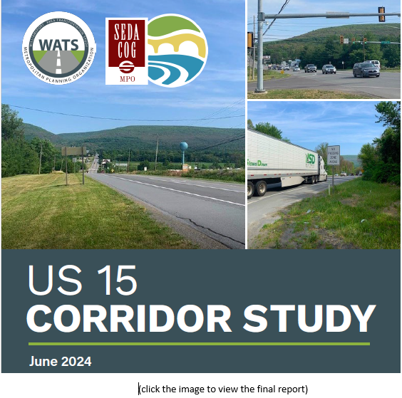
US 15 Corridor Study
The US 15 Corridor Study and recommendations are now available. The US 15 Corridor Study was a collaborative study between PennDOT District 3, PennDOT Center for Program Development and Management, WATS MPO, SEDA-COG MPO, Brady Twp., Clinton Twp., and Gregg Twp. The Study recommendations will be used to scope and implement future US 15 corridor projects and improvements.

The CSVT Special Impact Study Virtual Meeting was held on Monday, September 13, 2021
You can view the meeting agenda, the CSVT Draft Report and the public meeting presentation below.
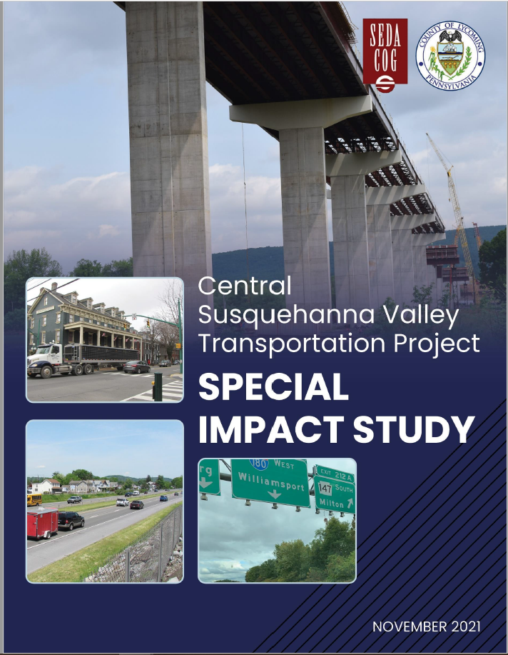
CSVT Report

(click the image to view the final report)
CSVT Public Meeting Presentation

(click the image to view the public meeting presentation)
Example Maps
Central Susquehanna Valley Transportation (CSVT) Project Land Use & Transportation Impact Special Study
The purpose of this special study is to evaluate the overall land use and transportation system impacts resulting from the completion of the Central Susquehanna Valley Transportation Project on the growth areas of Lycoming County. Focus will be placed on the Interstate 180 corridor from the Lycoming/Northumberland County line to its connection with US 15 as well as the US 15 corridor between the Lycoming/Union County line and its connection with Interstate 180. As a result of this study an action plan will be developed to help ensure orderly land development patterns, smart growth and a safe and efficient multi-modal transportation system that is responsive to increased traffic demand.

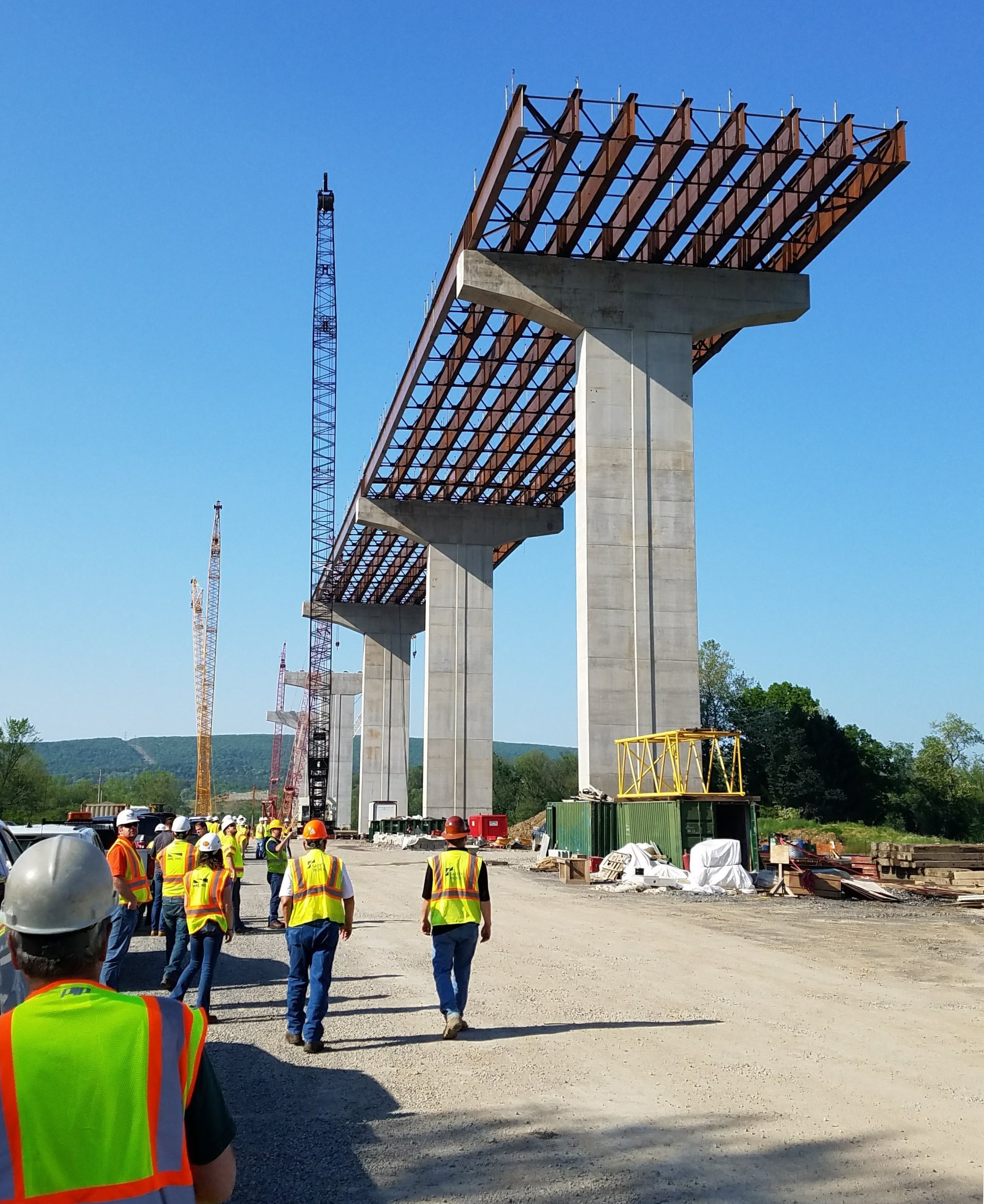
Image of bridge construction in the CSVT Nothern Section which will span the West Branch Susquehanna river between US 15 and PA 147.
Frequently Asked Questions
What is the purpose of the CSVT Study?
The Williamsport and SEDA-COG Metropolitan Planning Organizations (MPOs) worked collaboratively with the Pennsylvania Department of Transportation (PennDOT) in conducting the study for the purpose of developing an action plan to help ensure orderly land development patterns, smart growth, and a safe and efficient multimodal transportation system, which is responsive to changes in travel demand resulting from the completion of the CSVT project.
What are the limits of the study area?
The study process examined an area reaching from the intersection of I-180 and US 15 in Williamsport, to points as far south as the northern terminus of the US 11/15 Selinsgrove bypass. The primary roadway corridors examined included I-180, US 11, US 15, and PA 147.
Does the study recommend new projects?
The study does not identify major new projects in the wake of the $865 million CSVT project. However, there are areas that have been identified where safety and operational improvement needs may need to be made over time after the CSVT project is completed. Project examples would include new traffic signals, signal re-timings, or other relatively low-cost operational improvements that may be needed as traffic patterns evolve. The study also recommends the adoption of improved land use management tools and techniques as a means of protecting the viability of the enormous investment being made in the region’s highway network.
How can I access the details of the study report?
Both the Williamsport MPO and the SEDA-COG MPO have uploaded a copy of the study report on their respective websites. Additionally, the MPOs have uploaded a copy of the study webmap, which includes all of the spatial data developed during the study process. This includes information such as: anticipated population and employment growth rates, zoning, vacant parcels, proximity to transportation access, and other variables affecting the region’s development potential.
How will the study be implemented?
The study report recommends the creation of an implementation task force that would work under the auspices of the MPOs. The MPOs and PennDOT will continue to work together in monitoring ongoing changes in traffic patterns and in the implementation of the action items identified within the study report. The project webmap will be used as a planning tool in study implementation.
How can I be involved?
The MPO planning process offers the best way for interested members of the public to be involved. The MPOs follow what’s known as a “3-C” process: planning that is continual, comprehensive, and cooperative. CSVT will remain a standing agenda item on future meetings of the MPO – and the public is encouraged to participate in the MPO planning process as it relates to CSVT and other aspects of the MPOs’ planning program.
Central Susquehanna Valley Transportation (CSVT) Project Updates
Visit the websites below to see project updates and the status of CSVT construction.
|
|